 NIWA - Metadata Catalogue
Creation year
2015
76 record(s)
Type of resources
Topics
Keywords
Contact for the resource
Provided by
Years
Formats
Representation types
Update frequencies
Status
Scale
-
NIWA surface sediment data from the NZOI A-Y stations that have been standardised to the dbseabed format. NIWA samples have been processed and QC'd by INSTAAR University of Colorado, Boulder. dbSEABED creates unified, detailed mappings of the materials that make the seafloor by efficiently integrating thousands of individual datasets. The goal is to bring decades of seabed information - and today's information - from marine geology, biology, engineering and surveys into one seabed mapping that can fulfil the community needs for ocean-bottom information on many spatial scales. The system deals with seabed texture, composition, acoustic properties, colour, geology and biology. Quality assurance is achieved by checks on data at data entry, by error-trapping in the data-processing software, and by working the data intensively in various collaborative research programs. dbSEABED was devised to be robust in an inexact and incomplete information environment - marine geosciences. There are two versions of the data available: (1) the archives data, which are available as MS Excel spreadsheets - one for each letter of the A-Z station registers; (2) NIWA nzSeabed standard data, which is the same standard afters being standardised by dbSeabed and are available as ASCII text files. The data are available at either Q:\Ocean_Geology\Sediment%20samples/ or file://niwa.local/groups/wellington/Ocean_Geology/Sediment%20samples/
-
Measurements of inorganic ion composition of monthly/fortnightly rainfall samples collected at Kelburn, Lauder, Puruki. Measurement locations and dates are given below: Kelburn (41.17° S, 174.46° E) from March 1983 to March 1992 Lauder (45.02° S, 169.41° E) from July 1982 to Oct 1993 Puruki (38.43° S, 176.22° E) from July 1989 to Feb1991
-
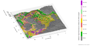
The New Zealand Land Cover Database (LCDB) is a multi-temporal, thematic classification of New Zealand's land cover. It contains 33 mainland classes (35 including the offshore Chatham Islands). The classification has evolved from version to version but backward compatibility has been maintained. Geographic features are described by a polygon boundary, a land cover code, and a land cover name at each of four nominal time steps; summer 1996/97, summer 2001/02, summer 2008/09, and summer 2012/13. The data set is designed to complement in theme, scale and accuracy, Land Information New Zealand’s 1:50,000 topographic database. LCDB is suitable for use in national and regional state-of-environment monitoring, forest and shrubland inventory, biodiversity assessment, trend analysis and infrastructure planning. The classification used in LCDB v4.1 is presented in the document 'LCDBClassesAtVersion4.1.pdf' and a table correlating LCDB classes over all four LCDB versions is presented in the document 'LCDBClassCorrelations.pdf'. Both of these documents are available as an attachment to this dataset in the LRIS portal (https://lris.scinfo.org.nz/) and on the LCDB project site (www.lcdb.scinfo.org.nz). LCDB v4.1 was released in July 2015 and includes corrections to all time steps 1996/97, 2001/02, 2008/09 and 2012/13. A description of work undertaken for this release (including that in all earlier releases) is presented in the Lineage section. Of particular note at 4.1 is the re-mapping of Chatham Islands - first mapped at version 2, but then not continued through versions 3.0, 3.3, and 4.0 because of resource constraints. “EditAuthority” and "EditDate" are attributes, maintained since version 3.0 to indicate authorship and nominal date of polygon mapping, edit or change. The data is referenced to the New Zealand Transverse Mercator 2000 projection (NZTM2000) which uses the NZ Geodetic Datum 2000 (NZGD2000). https://koordinates.com/from/lris.scinfo.org.nz/layer/48423/Errors in the data due to misclassification (not changes since mapping) or poor delineation can be reported to Landcare Research for inclusion in the next release using the online feedback mechanisms in https://lris.scinfo.org.nz/.
-
New Zealand Exclusive Economic Zone: The exclusive economic zone (EEZ) is a zone extending from the outer limits of the territorial sea to a distance of 200 nautical miles from the baselines of the territorial sea in which New Zealand, as the coastal state, has sovereign rights over the living and non living resources of the sea and seabed and other states have certain freedoms, including the freedoms of navigation and overflight. Maritime Boundary Definitions: http://www.linz.govt.nz/hydro/nautical-info/maritime-boundaries/definitions#zones Further References: http://www.linz.govt.nz/hydro/nautical-info/maritime-boundaries
-
The feasibility of shifting the consent area for marine farm 8049 in Oyster Bay, Queen Charlotte Sound to deeper water was assessed in this report. Sampling of the new site and nearby reef was conducted using a remote-operated camera (ROV) to attain photographs and video transects, as well as an acoustic dropper current profiler (ADCP) to measure currents in the ocean. Mathematical modelling was also incorporated (DEPOMOD modelling). Results showed that depths were suitable for the development of a finfish farm, and the farm would be beyond any significant depositional footprint if established. Although greater production was likely to result in enrichment effects to the benthic communities which may result in a replacement of existing benthic species by opportunistic species.
-

Seabed sampling of the nearshore region of the STB was conducted during a 3-day field survey undertaken from the 28th February to the 2nd March 2013. Seabed habitats were characterised at 36 sites (26 nearshore sites and 10 cross-shelf sites), using underwater video footage and still images (photo-quadrats). Representative habitats were then sampled using a benthic grab for surficial sediments and a benthic dredge to collect surficial macrobenthic specimens. Ninety-two percent of the seabed along the nearshore region of the STB was characterised by extensive soft-sediments that supported few macrobenthic organisms. The remaining 8% of the seabed (five sites) comprised hard substratum in the form of either low to moderate relief hard rock (6%) or variable relief mudstone (2%) outcrops. In contrast to mudstone outcrops, which supported low or negligible amounts of macrobenthos, hard rock outcrops supported abundant and diverse assemblages, with the two dredges sampled at Site 5 and 6 accounting for more than 25% of all specimens and 61% of all species collected during the survey.
-
The reports describes: 1. The methods of sampling & analyses used based upon questionnaires completed by iwi members. 2. Results for bioaccumulative contaminants, e.g. DDTs, PCBs, heavy metals, arsenic. 3. A discussion of the significance of these results to respective Iwi. 4. Recommendations for future research. Questionnaires were used to survey Te Arawa iwi members about their past and present consumption rates of traditional kai species. Hair samples were also collected from Te Arawa participants to assess possible exposure to mercury, a highly accumulative contaminant. Fish and/or shellfish (including longfin or shortfin eel, rainbow or brown trout, koura, pipi, mussel, flounder and kakahi) and watercress samples were gathered from multiple important harvesting sites in the different regions, and tested to assess their bioaccumulative contaminant levels. Aquatic sediments, which are known to concentrate contaminants on organic material, were sampled from these locations as well. Analytical data for fish, shellfish and sediment samples was collected for a range of organochlorine compounds, including DDT (historically used as a pesticide), chlordane (a pesticide) and dieldrin (an insecticide), arsenic (As),and heavy metals e.g. cadmium (Cd), chromium (Cr), copper (Cu), lead (Pb), mercury (Hg), nickel (Ni) and zinc (Zn). Eel and/or trout fillets were also analysed for selected polychlorinated biphenyls (PCBs). Watercress was analysed for heavy metals and arsenic only. Highest total DDT (ΣDDT) concentrations in Te Arawa rohe were detected in trout from the Upper Puarenga Stream site whereas the concentrations of ΣDDT were generally much lower in eels. Mercury concentrations in Te Arawa Rohe were generally highest in trout tissue, with the highest concentrations found at the Upper Puarenga Stream. Arsenic, cadmium and nickel concentrations were highest in pipis and mussels collected from the Maketu site and copper concentrations were higher in koura than any other species, with the highest concentrations ranging in Lake Rotokakahi and in Lake Okareka in Te Arawa rohe. The average concentration of mercury in the hair samples of Te Arawa iwi was three times higher than the study reference group and twice that of New Zealander’s who consume 1-4 meals of fish per month. The low number of Te Arawa responders in this study meant it was not possible to analyse potential links with consumption of wild kai. The ANZECC interim sediment quality guideline (ISQG) low values in Te Arawa rohe were exceeded for arsenic and mercury at 55 percent of sites sampled and for cadmium at 10 percent of the sites. The ANZECC ISQG high guideline value for arsenic was exceeded at 15 percent of sites and at 25 percent of sites for mercury. Based on the ratio of sediment to tissue metal concentrations, bioaccumulation “hotspots” were identified at Maketu (for shellfish), the Lower Kaituna site (for whitebait) and the Ohau Channel (for smelt). This health risk assessment using local iwi data on meal size and weekly consumption showed that mercury and arsenic were the primary contaminants of concern for Te Arawa iwi. The risk assessment indicated that there may be an increased risk to members of the Te Arawa iwi from long-term consumption of trout, pipi, mussel and watercress. Current consumption rates for eel are also close to exceeding safe levels. If kai was mostly gathered at the more contaminated sites then a significant risk exists when eating trout, eel and pipi.
-
This annual report summarises the operational performance and data integrity from the stations of Christchurch City Council’s (CCC) hydrometric network, as managed by the National Institute of Water & Atmosphere Ltd. (NIWA) for the 2014 calendar year. As at the end of the 2014 period, this CCC network comprises 76 data recording sites in the Christchurch area, consisting of 20 rainfall, 24 water-level, 31 groundwater and 0 miscellaneous stations. These sites are either permanent or project (temporary), most are telemetered via either cellular (GPRS) links or UHF radio. The remainder are manually downloaded or measured on a routine data collection basis (groundwater sites). Some sites are ECan / CCC ‘data shared’ sites or treated as additional datasets from NIWA specific sites, transferred from the NIWA climate database. For the 2014 period, data integrity was again maintained at a high level across most sites, despite interruptions from ‘rebuilding activity’ in the Christchurch area following on from the 2010 - 2011 earthquakes. Total missing record was again kept very low for the 2014 period at 0.71 % of the total hours recorded for all telemetered sites. Such levels of missing record are considered to be very acceptable when compared with New Zealand and international data collection standards. Additional work outside the Hydrometric Network Agreement has also been reported, detailing various projects and tasks that NIWA has assisted the CCC to complete during the year. These have ranged from additional labour orientated duties (flow gauging, new site installations) to sharing of expertise and advice (data handling & archiving, software support, hydrological site design). There are 10 sections that describe the data in this report. (a) Section 2 provides an overview of the weather during 2014 and a commentary on significant rainfall events which occurred during the year. (b) Section 3 outlines the quality assurance checks undertaken on the data and provides statistics on project data capture performance (c) Activities associated with the operation of rainfall, water-level / flow and groundwater sites are described in Sections 5, 6, and 7 respectively. (d) Activities associated with miscellaneous sites including evaporation, temperature (air and water), and any additional sites, are described in Section 8. (e) Proposed work activities that are anticipated by NIWA to be completed in 2015 are described in Section 9. (f) Section 10 details recommendations to further improve the management and operation of the hydrometric network. (g) A summary of any faults experienced during the year is detailed in Appendix 1, and an updated asset list defining the structures, instrumentation and other equipment at each site, is given in Appendix 2.
-
Just Mussels LTD engaged NIWA to complete a benthic survey and assessment as part of a coastal permit application for an extension to marine farm 8321, in Wilson Bay, Pelorus Sound. This assessment comprised side-scan-sonar swath mapping of sites to characterise seabed topography, photoquadrats of the seabed to ground-truth the side-scans, samples of epifauana, diver observations and core sampling. The report indicated that the proposed extension is not expected to cause any significant adverse ecological effects. The ecological effects of farming the proposed additional mollusc species are likely to be no greater than the effects of farming green mussels. Farming of the algal species (as proposed) is unlikely to have any significant ecological effects. The report identifies a dense population of burrowing shrimp (Upogebia hirtifrons) adjacent to the inshore boundary of the site. However, the report notes that there is unlikely to be any significant detrimental effect of the proposed extension to the shrimp burrow habitat.
-
This report briefly describes methodology and presents results for the analyses of contaminants and particle size distributions for catchpit sediment samples. TPH, TOC and heavy metal results were produced by Hill Laboratories. PAH and chemical marker compound results were produced by NIWA.