 NIWA - Metadata Catalogue
Creation year
2015
76 record(s)
Type of resources
Topics
Keywords
Contact for the resource
Provided by
Years
Formats
Representation types
Update frequencies
Status
Scale
-
NIWA surface sediment data from the NZOI A-Y stations that have been standardised to the dbseabed format. NIWA samples have been processed and QC'd by INSTAAR University of Colorado, Boulder. dbSEABED creates unified, detailed mappings of the materials that make the seafloor by efficiently integrating thousands of individual datasets. The goal is to bring decades of seabed information - and today's information - from marine geology, biology, engineering and surveys into one seabed mapping that can fulfil the community needs for ocean-bottom information on many spatial scales. The system deals with seabed texture, composition, acoustic properties, colour, geology and biology. Quality assurance is achieved by checks on data at data entry, by error-trapping in the data-processing software, and by working the data intensively in various collaborative research programs. dbSEABED was devised to be robust in an inexact and incomplete information environment - marine geosciences. There are two versions of the data available: (1) the archives data, which are available as MS Excel spreadsheets - one for each letter of the A-Z station registers; (2) NIWA nzSeabed standard data, which is the same standard afters being standardised by dbSeabed and are available as ASCII text files. The data are available at either Q:\Ocean_Geology\Sediment%20samples/ or file://niwa.local/groups/wellington/Ocean_Geology/Sediment%20samples/
-
Measurements of inorganic ion composition of monthly/fortnightly rainfall samples collected at Kelburn, Lauder, Puruki. Measurement locations and dates are given below: Kelburn (41.17° S, 174.46° E) from March 1983 to March 1992 Lauder (45.02° S, 169.41° E) from July 1982 to Oct 1993 Puruki (38.43° S, 176.22° E) from July 1989 to Feb1991
-
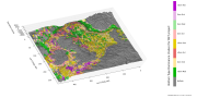
The New Zealand Land Cover Database (LCDB) is a multi-temporal, thematic classification of New Zealand's land cover. It contains 33 mainland classes (35 including the offshore Chatham Islands). The classification has evolved from version to version but backward compatibility has been maintained. Geographic features are described by a polygon boundary, a land cover code, and a land cover name at each of four nominal time steps; summer 1996/97, summer 2001/02, summer 2008/09, and summer 2012/13. The data set is designed to complement in theme, scale and accuracy, Land Information New Zealand’s 1:50,000 topographic database. LCDB is suitable for use in national and regional state-of-environment monitoring, forest and shrubland inventory, biodiversity assessment, trend analysis and infrastructure planning. The classification used in LCDB v4.1 is presented in the document 'LCDBClassesAtVersion4.1.pdf' and a table correlating LCDB classes over all four LCDB versions is presented in the document 'LCDBClassCorrelations.pdf'. Both of these documents are available as an attachment to this dataset in the LRIS portal (https://lris.scinfo.org.nz/) and on the LCDB project site (www.lcdb.scinfo.org.nz). LCDB v4.1 was released in July 2015 and includes corrections to all time steps 1996/97, 2001/02, 2008/09 and 2012/13. A description of work undertaken for this release (including that in all earlier releases) is presented in the Lineage section. Of particular note at 4.1 is the re-mapping of Chatham Islands - first mapped at version 2, but then not continued through versions 3.0, 3.3, and 4.0 because of resource constraints. “EditAuthority” and "EditDate" are attributes, maintained since version 3.0 to indicate authorship and nominal date of polygon mapping, edit or change. The data is referenced to the New Zealand Transverse Mercator 2000 projection (NZTM2000) which uses the NZ Geodetic Datum 2000 (NZGD2000). https://koordinates.com/from/lris.scinfo.org.nz/layer/48423/Errors in the data due to misclassification (not changes since mapping) or poor delineation can be reported to Landcare Research for inclusion in the next release using the online feedback mechanisms in https://lris.scinfo.org.nz/.
-
New Zealand Exclusive Economic Zone: The exclusive economic zone (EEZ) is a zone extending from the outer limits of the territorial sea to a distance of 200 nautical miles from the baselines of the territorial sea in which New Zealand, as the coastal state, has sovereign rights over the living and non living resources of the sea and seabed and other states have certain freedoms, including the freedoms of navigation and overflight. Maritime Boundary Definitions: http://www.linz.govt.nz/hydro/nautical-info/maritime-boundaries/definitions#zones Further References: http://www.linz.govt.nz/hydro/nautical-info/maritime-boundaries
-
Measurements of greenhouse gases and other trace gases in air sampled at Baring Head (New Zealand) and Arrival Heights (Antarctica)
-
This report briefly describes methodology and presents results for the analyses of contaminants and particle size distributions for catchpit sediment samples. TPH, TOC and heavy metal results were produced by Hill Laboratories. PAH and chemical marker compound results were produced by NIWA.
-
Samples of oysters from multiple sites in the Manukau Harbour and transplanted mussels from multiple sites in Auckland estuaries and Waitemata Harbour were analysed for %lipid, organochlorine pesticides (OCPs), polychlorinated biphenyls (PCBs), and polycyclic aromatic hydrocarbons (PAHs). Analytical data for oysters and mussels were presented along with analytical procedures, methods and a quality assurance summary. The report includes lipid-normalised data sets of selected contaminants for comparison with earlier data sets.
-
Datasets produced from this study include vertical aerial photographs collected on four consecutive days during July 2001 when the river discharge was lowered in steps from approximately 350 to 150 to 120 to 90 m3/s. These were analysed at two reaches by classifying island shores directly off the imagery. The 4.2 km long reach near Priest Road has a braiding intensity typical of much of the Lower Waitaki, while the 3.6 km long reach downstream from Kurow samples the transitional, semi-braided segment of the river. At the Priest Road reach, islands were also mapped at discharges over the range 80-160 m3/s using the results of 2d hydrodynamic modelling undertaken in a previous study. The main findings were: At the more intensely braided reach near Priest Road, the analysis of islands classified off the aerial photographs showed little difference in the frequency distribution of island size as discharge changed over the range 354-87 m3/s. As the discharge reduced from 147-116 m3/s, there was only a relatively small reduction in the number of islands with areas exceeding 0.25 ha (from 12.1 to 10.7 islands per km length of reach), while from 116 to 87 m3/s there was no change in island number. As the island size threshold is increased above 0.25 ha there were only marginal changes in the number of islands going from 147 to 116 m3/s. The total area of all islands larger than a threshold area peaked when the discharge was at 116 m3/s, irrespective of the threshold area chosen. At the less braided reach near Kurow, the aerial photograph analysis showed fewer islands as discharge reduced from 354 to 147 m3/s, while from 147 to 87 m3/s the distributions of small-mid size islands differed erratically, with only a few less islands overall. The number of islands with areas exceeding 0.25 ha reduced from 2.8 to 1.9 per km of channel as the flow reduced from 147 to 87 m3/s. The rate of reduction in the number of islands going from 147 to 87 m3/s decreased as the island size threshold was increased above 0.25 ha. The total area of all islands larger than a threshold area increased as discharge decreased. These patterns are rendered uncertain, however, by the small number of islands observed in this reach. The 2d hydrodynamic modelling at the Priest Road reach underestimated the number of islands and therefore the model based results were considered less reliable than those obtained from the direct mapping of island shorelines from imagery. The underestimation was because the modelling often missed sending flows through small side-braids or it drowned-out small emergent bars. These can be related to errors in the riverbed topography used by the model and to topographic smoothing associated with the modelling grid.
-
Resource consents for the application of the de-icing agent calcium magnesium acetate (CMA) to a number of sections of the South West Central Plateau State Highway Network (Discharge Permits 103273 and 103274) require monitoring of benthic macroinvertebrates before and after winter in years 1, 2, 5, and 10 following the commencement of the permit.
-
Plant and Food Research engaged NIWA to design and implement a survey programme to monitor the effects of an experimental fish feeding operation on the benthic environment in Nelson Haven, to satisfy resource consent requirements. This was conducted to assess whether the feeding programme would adversely affect the local benthic environment, the survey focussed on measuring key indicators of organic enrichment. To do this, a range of sediment physicochemical parameters were characterised using benthic cores and sledding methods. Parameters included: sediment grain size, sediment organic content, sediment colour and smell, and redox potential of surficial sediment,and also biotic features including: the composition of animal communities living upon and within the sediments, and the distribution and abundance of macroalgae. This report describes the survey undertaken 8 months after the commencement of the fish feeding activity. Benthic and sediment data from 7 sites have been processed, checked, analysed, and summarised in the client report. Previous reports in this time series are: Brown, S. N. (2014a). Wildfish 2030: Benthic Monitoring Baseline Survey. Report prepared for Plant and Food Research Ltd. NIWA Client Report No. NEL2014-013. 18 p. Brown, S. N. (2014b). Wildfish 2030: Benthic Monitoring Survey – First post baseline survey. Report prepared for Plant and Food Research Ltd. NIWA Client Report No. NEL2014-021.18 p.